From hype to habit: what fishing apps really changed on the water
By 2026, the idea of “fishing apps worth using” had become a kind of promise whispered into every tackle box. The pitch was simple: a fishing app could turn scattered weekends into a repeatable system, using real time data, smart maps, and catch logs to help anglers catch more fish on familiar water. The reality on most phones is a clutter of half used tools, while the best lessons still come from the tenth cast in the rain.
When the first big fishing apps arrived, they sold a clear story. Log every catch, track every moon phase and barometric pressure swing, then let the software crunch the data and predict when and where the best fishing would happen next time. Many anglers dutifully entered each bass, pike, or mixed species, only to stop opening the app once the novelty of catch logging wore off and the promised insights never quite materialized.
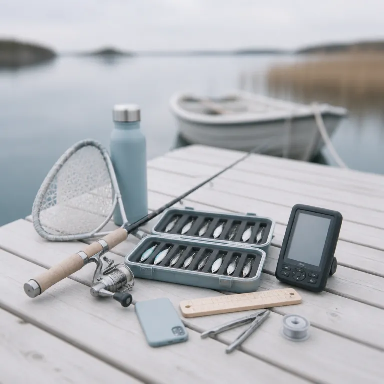
On my own phone, I ran Fishbrain, Anglr, and a couple of smaller fishing logbook apps side by side. I marked fishing spots on three different maps, saved duplicate GPS waypoints, and still ended up going back to the same rocky point on Lac des Deux Montagnes because the wind and the water colour looked right. The apps helped me remember which soft plastic produced the first catch of the morning, but they did not replace that gut check you get from watching the shoreline for ten quiet minutes.
For many weekend anglers, the promise of the best fishing apps turned into a quiet data hoarding habit. You end up with hundreds of fishing points, dozens of access points, and years of time on the water logs that never get reviewed in any meaningful way. The app becomes a digital tackle tray, full of lures you never tie on, while the same three confidence baits keep catching fish.
That does not mean these tools failed completely, only that their impact is narrower than the marketing suggested. A fishing app can shine when it gives you clean offline maps, clear satellite imagery, and simple weather forecasts that you actually check before leaving the driveway. Used that way, modern fishing apps look less like magic and more like a sharper version of the notebook every serious angler used to keep, especially when you treat them as planning tools instead of crystal balls.
The features that genuinely help you catch more fish
Strip away the badges and social feeds, and a few core features consistently help anglers catch more fish. High quality contour maps, especially when paired with satellite imagery, make it easier to understand how water depth, structure, and access points line up on a new lake. When you can see a submerged point on the map and the weed edge on the satellite layer, your first cast lands closer to the strike zone.
Apps like Navionics, Fishing Points, and onX Fish lean into this mapping strength. They combine detailed bathymetric charts with GPS waypoints so you can mark every productive bass hump, every fly fishing seam, and every safe route through shallow water. For a weekend angler with limited time, having those waypoints ready means you spend less time idling and more time with a lure actually working.
Weather and water related tools are the second pillar of genuinely useful fishing apps. Real time weather forecasts, barometric pressure trends, and moon phase information do not guarantee a catch, but they help you choose between a shallow crankbait bite and a deeper jigging pattern. When you can see that the pressure has been stable for two days and the moon phase is pushing fish shallow at dusk, you plan your time on the water instead of guessing.
Some apps go further with time on water overlays, showing historical data for water temperature or level changes. On a river like the Saint Maurice, knowing that a small rise in water level usually pushes baitfish tight to the bank can change how you approach evening bass fishing. The most practical fishing apps turn those patterns into simple visuals, not dense tables that only a meteorologist could love.
Then there is the quiet power of offline maps and cached satellite imagery. When your signal dies on a backcountry reservoir, an app that still shows your GPS waypoints and fishing spots is worth more than any flashy tournament style leaderboard. If you pair that with a few refined lures for pressured bass from a resource like this guide to refined striped bass lures that convert follows into strikes, you have a practical system instead of a digital distraction.
To see how these tools differ in practice, compare three common use cases: Navionics focuses on detailed contour maps and route planning for boats, Fishing Points blends basic mapping with simple weather and solunar forecasts for shore anglers, while onX Fish emphasizes access points, property boundaries, and offline satellite imagery for exploring new water. All three can help you catch more fish, but only if you match their strengths to the way you actually fish.
Gamification, social feeds, and the data hoarding trap
Most fishing apps did not stop at maps and forecasts, because maps and forecasts are hard to monetize. They layered on social feeds, catch badges, streak counters, and tournament style challenges that feel exciting for a week and then quietly push you to fish for the app instead of for yourself. When every catch becomes content, the line between a fishing trip and a scrolling session gets blurry fast.
Fishbrain and similar social fishing platforms built huge communities by letting anglers share every catch, every lure, and every spot with a tap. The free version of Fishbrain gives you a taste of that social rush, while Fishbrain Pro adds more detailed maps, extra data, and more suggested fishing spots based on other users. For some anglers, especially beginners, that community can shorten the learning curve, but it can also create pressure to chase numbers instead of learning your home water.
The real trap is logging hundreds of catches without ever sitting down to read your own data. I have seen anglers with years of catch logging in multiple apps, from bass fishing trips on small Québec reservoirs to fly fishing weekends on the Jacques Cartier River. When asked what patterns they learned, they shrug and say the app probably knows, as if the data itself could fish for them.
Used well, a fishing app should help you answer simple questions. Do I catch more fish on overcast weather with falling barometric pressure, or on clear high pressure days when the moon phase is near full? Do my kids stay engaged longer when we target active panfish near shallow fishing points, or when we grind for one big bass off a deep hump?
If you want to build real skill, you need to treat the app like a structured notebook, not a slot machine. That means reviewing your own data every few months, deleting duplicate GPS waypoints, and writing down three lessons from each season in a physical notebook. When you combine that with practical family focused advice such as this guide on keeping kids engaged past the first fifteen minutes, the technology starts serving your fishing instead of the other way around.
What expert anglers actually use, and how to protect your spots
Spend time with anglers who consistently catch fish, and you notice something. Their phones are usually in a dry bag, not on the casting deck, and they lean on one or two reliable fishing apps instead of a full screen of icons. They care less about badges and more about clean maps, reliable weather, and a simple way to mark a new rock pile.
On my own boat, the core stack is boring but effective. I use one fishing app for maps and offline satellite imagery, one for weather forecasts and barometric pressure trends, and a basic note system for catch logging with lure, depth, and water temperature. When I guide beginners on local lakes, I tell them that the best fishing tech is the one they can operate with cold fingers in a light rain.
Privacy is the other quiet reason serious anglers keep their app list short. Any time you log a catch with precise GPS waypoints, you are handing location data to a company that may use it to suggest fishing spots to thousands of other users. Some platforms anonymize and aggregate that data, while others lean on it to power premium features and pricing tiers that encourage more sharing.
If you care about protecting fragile fisheries or small community lakes, read the privacy policy before you log your next trophy bass. Turn off automatic spot sharing, avoid posting exact access points, and think twice before syncing your entire catch history to a new app that promises free features in exchange for more data. A simple rule helps here, and it applies whether you are choosing a fishing app or a new fishing tournament shirt for your next club event.
Use technology where it clearly improves safety, navigation, or learning, and ignore the rest. That might mean pairing onX or onX Fish with Google Earth for scouting, then leaving Fishbrain Pro at home when you explore a tiny backcountry pond with wild trout. The more your apps fade into the background, the more you can pay attention to wind lanes, bird activity, and that subtle change in water colour that no screen can fully capture.
Key statistics on fishing apps and angler behaviour
- A survey by the Recreational Boating and Fishing Foundation (RBFF) reported that more than 40% of active anglers had tried at least one fishing app, but fewer than 20% used any single app regularly after six months, showing a large gap between initial curiosity and long term habit. This figure is based on self reported usage in RBFF participation research, not on direct app telemetry, and the detailed findings are available in RBFF’s published special reports on angler behaviour.
- Industry data from mobile app analytics firms indicated that location based outdoor apps, including fishing apps, saw download spikes of over 30% during peak fishing seasons, while retention rates after the first month often fell below 25%, suggesting that many anglers treat them as seasonal tools rather than year round systems. These estimates come from aggregated, anonymized install and active user metrics reported in annual outdoor and navigation app market summaries.
- Privacy research from digital rights organizations found that a majority of popular outdoor and navigation apps collected precise GPS data and shared some form of anonymized location information with third party partners, underlining the need for anglers to review permissions and privacy settings before logging sensitive fishing spots. The findings typically rely on app store disclosures, privacy policies, and network traffic analysis documented in recurring privacy audits of mobile location services.
- Market reports on outdoor technology showed that mapping and offline navigation features ranked as the most valued functions among anglers using fishing apps, while gamified elements such as leaderboards and badges ranked significantly lower, reinforcing the idea that practical tools beat social features for serious fishing use. These rankings usually come from user surveys that ask anglers to rate specific features by importance, and they consistently place detailed contour maps, GPS waypoints, and offline charts near the top.